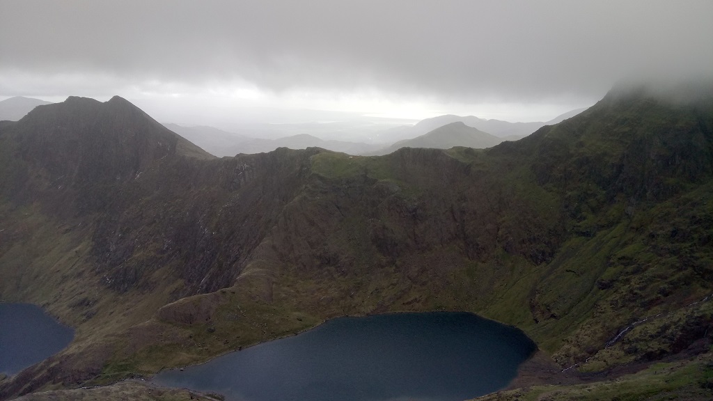
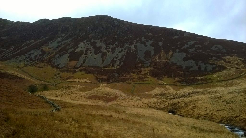
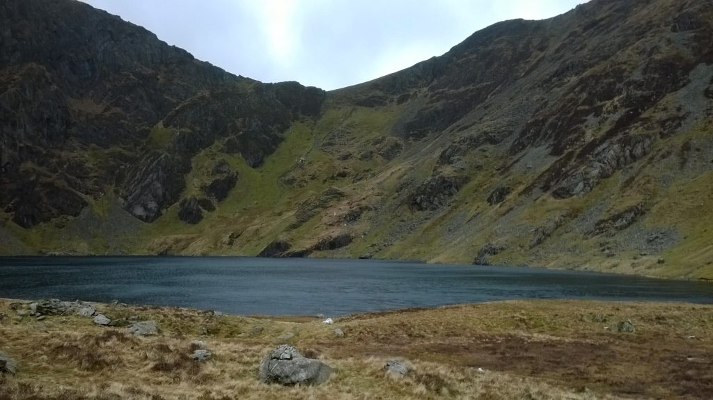
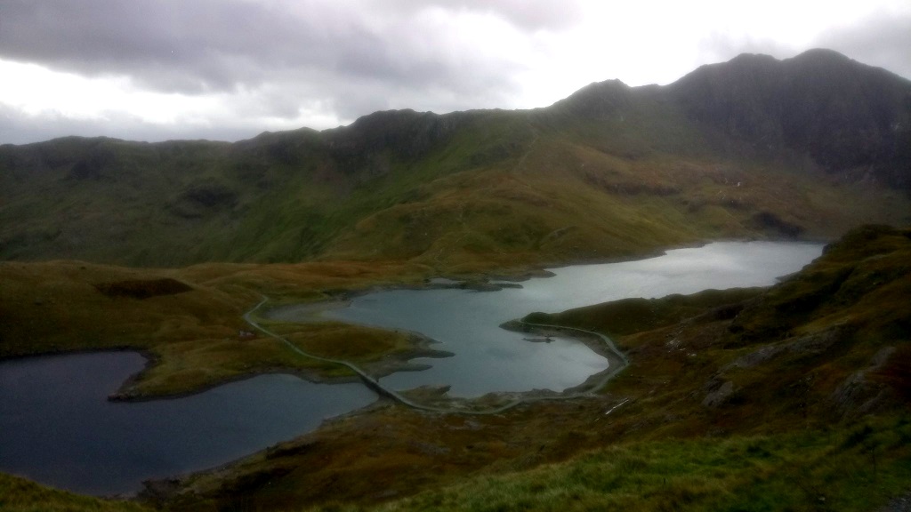
Table of contents
- Introduction
- The Welsh Language (Cymraeg)
- Towns and Places
- The National Parks (Snowdonia, Brecon Beacons)
- Conclusion
1. Introduction
Wales was the first more remote destination I went to see after leaving engineering school, and it was the first opportunity to improve my English skills beyond university courses or the workplace.
I visited this small (the population is some three million), culturally appealing and scenically impressive country in the western part of the British Islands for the first time in early 2014.
However, my first trip had solely been a short stay in the former industrial town Merthyr Tydfil and the capital Cardiff.
Three ensuing visits (the last one in 2018) yet offered more time to get in contact with locals and to explore the central and especially the northern regions of Wales, including the national parks (Brecon Beacons and Snowdonia).
There I set off for several demanding hiking trips where I got accustomed to the unpredictable weather in Britain, and here I learned many interesting details about the domestic culture.
Culturally most fascinating is certainly Welsh, a Celtic language spoken by roughly one million people mainly in the north of Wales.
2. The Welsh Language (Cymraeg)
Welsh, which is beside English the official language in Wales, belongs to the large Indo-European language family (like the Slavic and Germanic languages),
A close relationship exists naturally with other Celtic languages, Irish and Gaelic, respectively.
In principle, everything is bilingual in Wales. For instance roadsigns, leaflets, and captions in advertisements.
Welsh is a mandatory subject in schools. That is without doubt the most important reason the number of Welsh speakers is increasing after there had been serious concerns some decades ago the language could become extinct.
Of course it is sufficient to have solid English skills to get by in Wales. I never met anyone who was solely speaking Welsh.
Below a few examples for Welsh phrases and words that one may encounter in Cymru:
Thanks – Diolch; Hello – Shwmae; Forest – Coed; Lake – Llyn; yes – ie; no – na
If I had to describe it, I would depict the language as quite peculiar and sounding like a compound of Danish and Dutch.
3. Towns and Places
In the following I want to illustrate a selection of individual places in Wales.
Aberystwyth
The medium-sized town of Aberystwyth (about 13.000 inhabitants) is situated on the western coast of Wales at the Cardigan Bay.
The town possesses a romantic promenade with many historical buildings, most remarkable is probably the Old College that belongs to the Aberystwyth University.

In Wales, castles (or remains of them) are omnipresent, and Aberystwyth Castle had been one of those centuries-old fortifications.
Unfortunately only a few wall-fragments and debris of the gates remain today for the castle was razed to the ground in 1649 by henchmen of Oliver Cromwell. Maintenance of a structure exposed to a unforgiving climate was in any case a monumental task to begin with.
The National Library of Wales
Despite its comparatively small size, Aberystwyth became the location of The National Library of Wales1 at the beginning of the 20th century.
This institution has the privilege to claim a copy of every book issued in the United Kingdom and Ireland, and the main duty of the Library is to preserve and facilitate material related to the Welsh language.

The library is open to the public. Everybody can request a membership (my membership No. is 1564666) and borrow books from the archives.
So I seized the opportunity to explore a tiny fraction of the book inventory in one of the vast reading rooms.
1 the Welsh translation reads “Llyfrgell Genedlaethol Cymru”
Conwy
Conwy (15.000 inhabitants), lying at the northern coast boasts with a well-preserved and well-known fortification, the Conwy Castle.
This town is fairly representative for the scores of Welsh towns not only endowed with a small castle (ruin) but with an extensive medieval fortification structure.

Conwy Castle was erected in the 13th century by the English crown for the purpose of controlling North Wales, but it got military obsolete in the aftermath of the English Civil War (17th century).
The medieval city-walls in Conwy are like the castle well preserved and accessible for tourists.

Holy Island
The town Holyhead (11.000 inhabitants) is situated at the very north-western end of Wales on Holy Island, which is itself part of the historic county (and island) Anglesey.

On a tiny and rocky island a few kilometers off from Holyhead a striking piece of architecture, the South Stack Lighthouse, was built at the beginning of the 19th century.
The tower with an attached building, the complex employing no on-site personnel present-day, is open seasonally for regular visitors.

Not far off from the lighthouse there exists a small bird observatory. The species and the bird populations are very numerous around this unique area with its steep precipices and shores.
4. The National Parks (Snowdonia, Brecon Beacons)
4.1 Snowdonia
The national park Snowdonia covers a good deal of northern Wales, with a total area of approximately 2200 square kilometers.
Snowdonia is the largest of in sum three national parks in Wales.
Mount Snowdon
Beside having the largest total area, the national park possesses also the highest peak on the British Island outside the borders of Scotland, Mount Snowdon or Yr Wyddfa (1085 meters AMSL, i. e. Above Mean Sea Level; every stated height in this article is AMSL).

The mountain is probably the most popular tourist destination in Wales in terms of a small outdoor adventure. So it might be a rather awkward experience ascending the peak on weekends and holidays since there can be plenty of visitors and fellow hikers.
A mountain railway from the town Llanberis to a spacious refuge close to the summit generates an additional amount of tourist numbers, though the train journey is comparatively expensive in my opinion (here is the price list).
Fortunately there exist several trails to Mount Snowdon, so if you choose a more difficult one chances are that you don’t stuck in a logjam.

Regardless of choosing a more technical trail or an easier tour, it is likely that you have to deal with bad weather conditions. That means more precisely not low temperatures, but strong wind, fog, and sometimes heavy rainfall as a consequence of the proximity to the Atlantic Ocean.
But the view of the surrounding landscape is absolutely breathtaking and worth all the effort of the climb and the exposure to the rough weather conditions.


During a hike through Snowdonia one will see many so-called cirques, concave geological formations usually filled with melting water (so they form mountain lakes without inflow or outflow).
The Rhyd Ddu Path to Mt. Snowdon is a good instance, where you have a excellent view onto several of those depressions.
Cadair Idris
In the south of Snowdonia lies the Cadair Idris mountain and its peak Penygadair.
Hiking to the peak is challenging, though the height of the mountain doesn’t strike you as very intimidating at first (893 meters). Yet in Dolgellau or in Minffordd you actually start on sea level.
In sum, I made three attempts to climb Penygadair: a first one I did in spring time on the Minffordd Path; a second and a third one I did in autumn on the Minffordd Path and on the Pony Path, respectively.

My first summit bid was not successful, I had to turn back literally just a few paces short of the peak. The wind was dreadful and I had all but sight during the ascent. Occasional gusts seemed to have the potential to sweep me down the steep crests.
The second time I climbed with a very good buddy of mine. It was not our first trip together, and I had no doubt that we won’t reach the top. However, as we were descending the northern ridge of the mountain we got lost as we weren’t able to make out the trail in the dense fog. In the end, we had to walk for two extra hours through heavy rain and a storm.
This was no fun at all, but nevertheless a valuable experience and a lesson about team-work.

Sadly there did occur a tragedy as well on this very afternoon: another hiker got lost (we didn’t know him, and we hadn’t taken any notice of fellow hikers during our ascent) and was found dead by a rescue team a couple of hours after an apparent fall, as we learned the next day.
I was successful with my third attempt as I climbed the Pony Path near Dolgellau, again on a solo tour.
And again I was on the brink of turning back prematurely, once more because of a heavy storm and poor visibility (that’s also the reason I never made any photos from higher altitudes). On this day, several hikers passed me by during my ascent, all quitting their summit attempts due to the dreadful weather conditions.
4.2 Brecon Beacons
The Brecon Beacons National Park (the second largest in Wales) is located in Central Wales, with Pen y Fan as the highest elevation (886 meters).

Aside from this peak, this area is not necessarily a popular tourist destination.
It may happen that you hike for several days in a row without coming across another human being. The British military also utilizes this secluded area for its special forces (SAS) training.

The town Brecon, lying at the northern edge of the national park is a good starting point for hiking and cycling tours through the Brecon Beacons.
5. Conclusion
I hope you enjoyed this article about Wales and some facets of the Welsh culture.
One interesting thing I haven’t mentioned so far: like in the other parts of Great Britain you have of course left-hand traffic in Wales.
This demands an extra amount of attention in the road traffic in case one is not accustomed to it. Especially if one drives a nice but unfamiliar French rental car.
So I am glad about the fact that no mishaps had happened to me during my adventures in Wales. Neither on my hiking tours in solitary mountain ranges nor during my car rides.
Featured image: Aberaeron, Cardigan Bay