Kriváň and Rysy are well-known mountains in Slovakia in the western High Tatras.
Štrbské Pleso, the final station of the meter-gauge railway Tatranské Elektrické Železnice (TEŽ), is a convenient starting point to get to either peak in three to four hours.
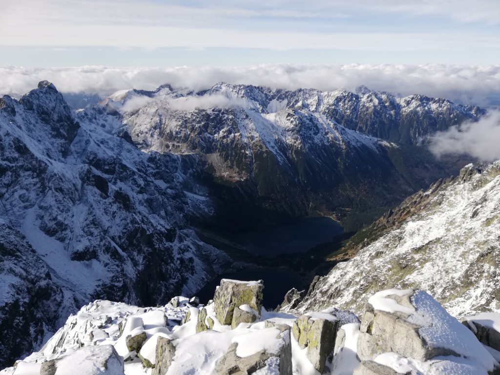
Kriváň , October 1
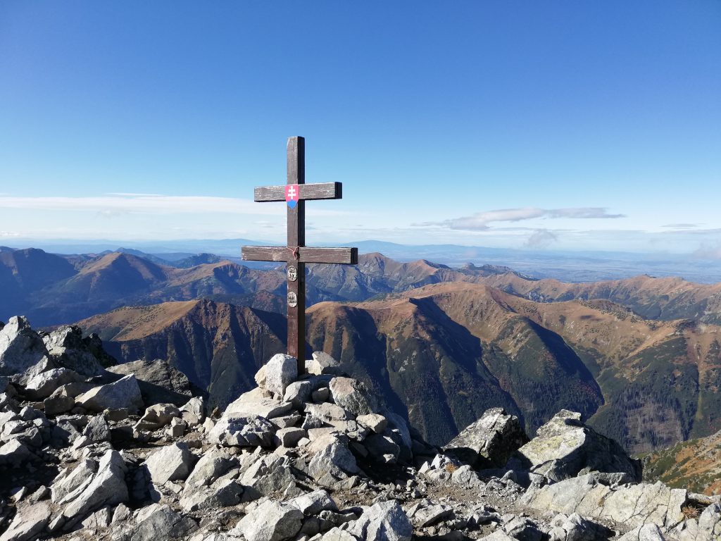
Kriváň (2494 meters AMSL, i. e. Above Mean Sea Level; every height stated below is AMSL), so named because of its distinctive shape1, is the most famous mountain in Slovakia and a national symbol even though it is not the highest peak in the Carpathians (Gerlachovský štít is the highest with a peak elevation of 2654 meters).
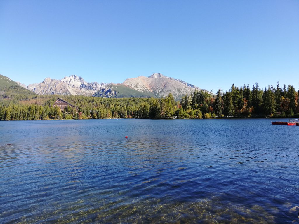
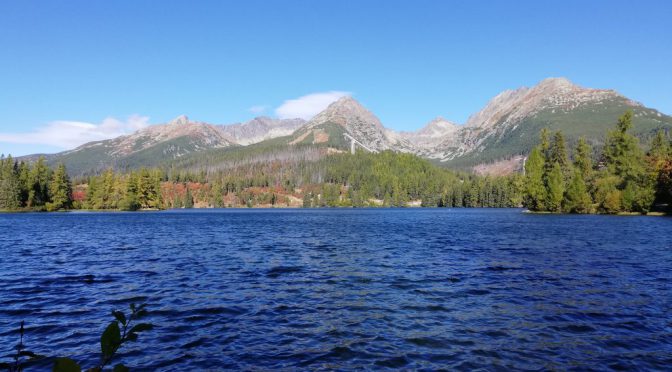
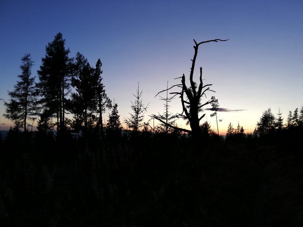
My start and finishing point on this bright sunny day was the gorgeous Štrbské pleso mountain lake (a glacial lake), lying to the north-west of the aforementioned town bearing the same name (but with capital letter P: Štrbské Pleso).
From there (on 1346 meters) I followed the red marks westwards on the first section of the trail. Red is usually the color for long distance trails, and here the marks label the Tatramagistrale that leads across the entire Tatra foothill and connects all the principal refuges.
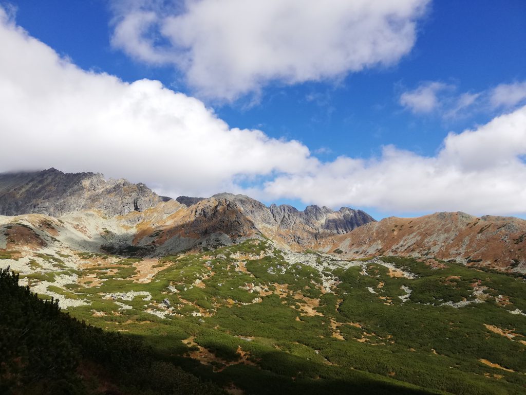
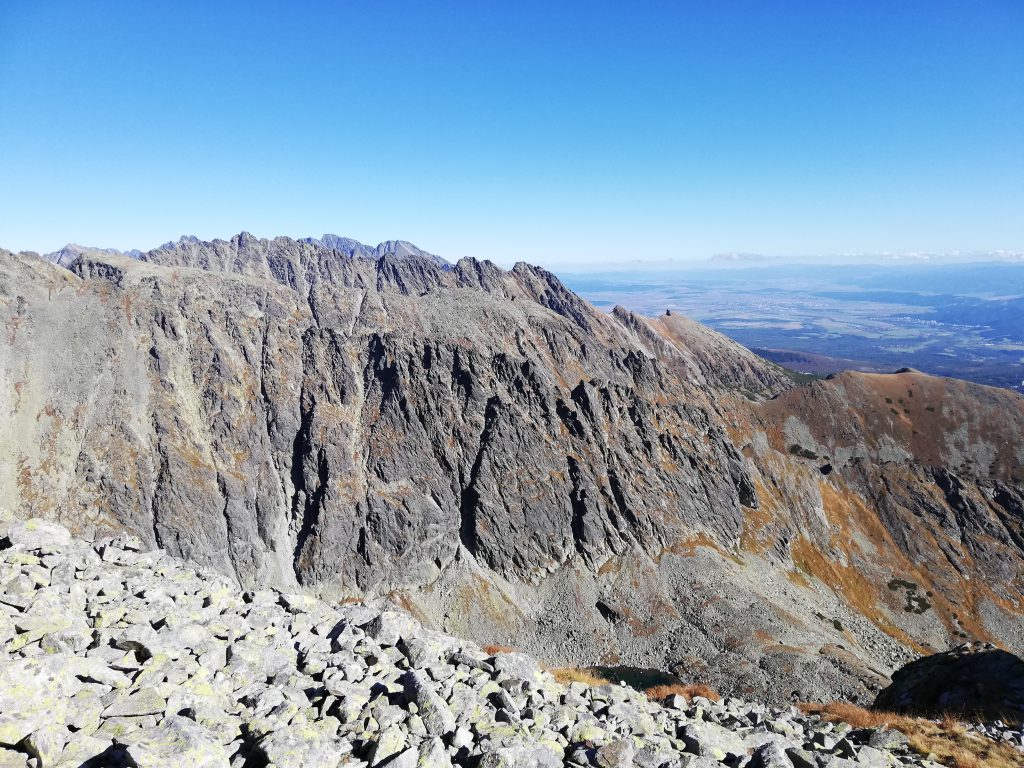
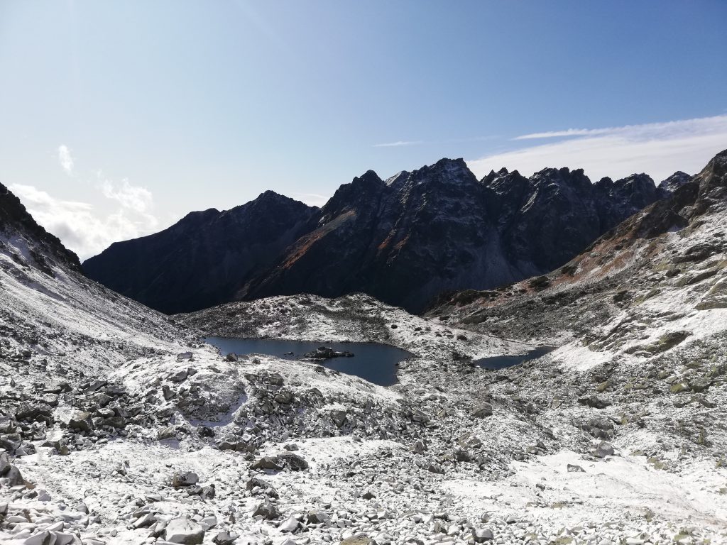
At Jamské pleso, a small mountain lake (1447 meters) I turned northwards on a now blue marked trail, where I started ascending the steep and treeless mountain slopes, with the impressive Važecká dolina valley on my right hand side.
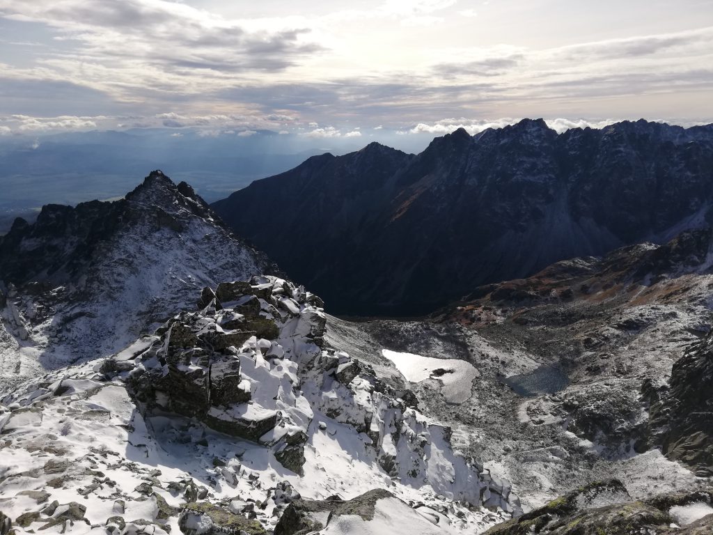
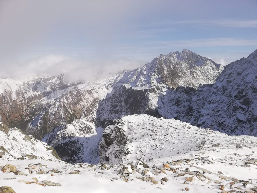
The ascent on the final sections can be exhausting at times, but is otherwise not really technical. On the peak you are rewarded with an expansive view to Poland in the north and onto the Low Tatras (Nízke Tatry) in the south.

For climbing down there had been the option to take the green marked path to Tri Studničky (“Three Wells”), passing by the Grúnik peak on 1576 meters. I decided instead to walk on the blue marked path back to Štrbské Pleso.
Rysy, October 3
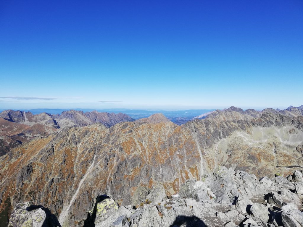
This mountain possesses three peaks (the highest of those three is 2503 meters, Rysy is a plural form), straddling the border between Poland and Slovakia.
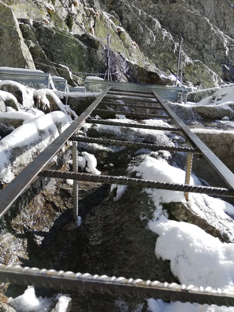
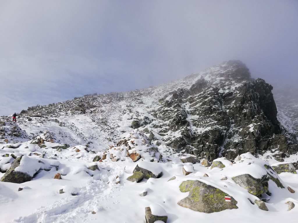
Rysy is the highest mountain in the High Tatras that is accessible for individual visitors2, so there do exist cairns and markings leading to the peak, a red marking beginning at the Nad Žabím potokom junction.

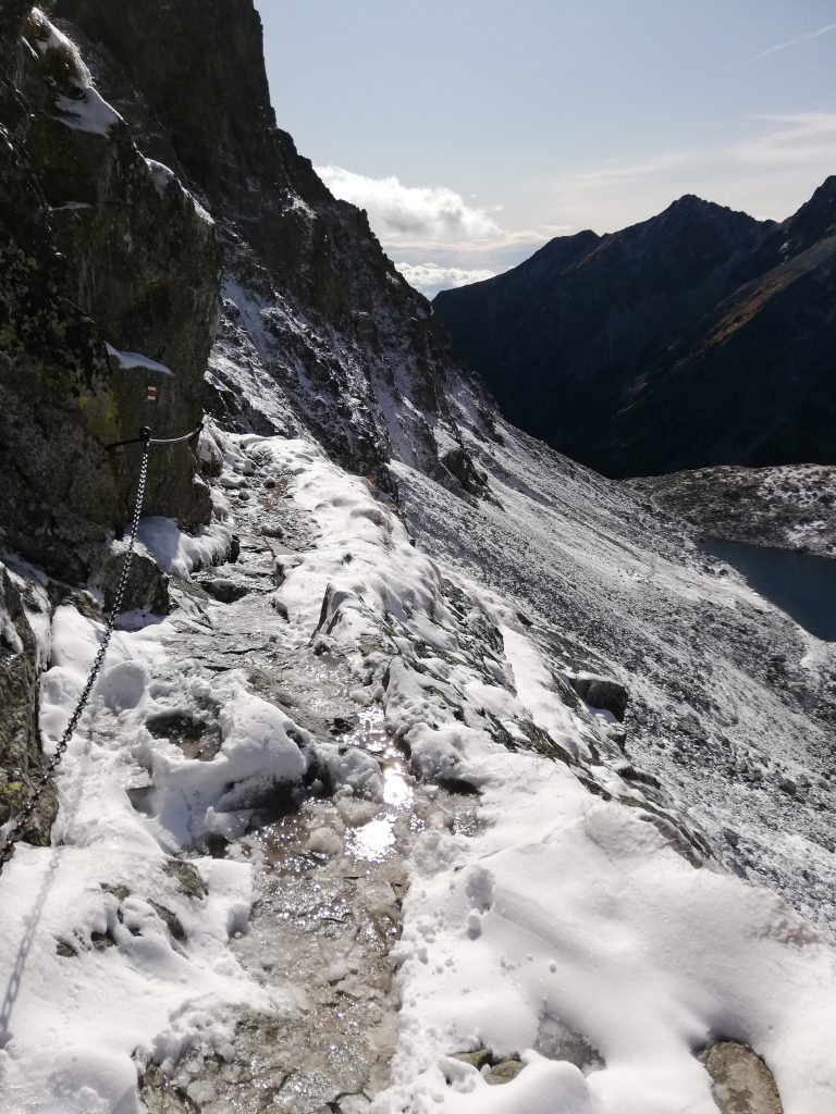
A few sections of the trail boast ladders and other metal supports to make the peak accessible for families and unexperienced people, and even with a thin layer of snow there exist no actual obstacles from a technical point of view.
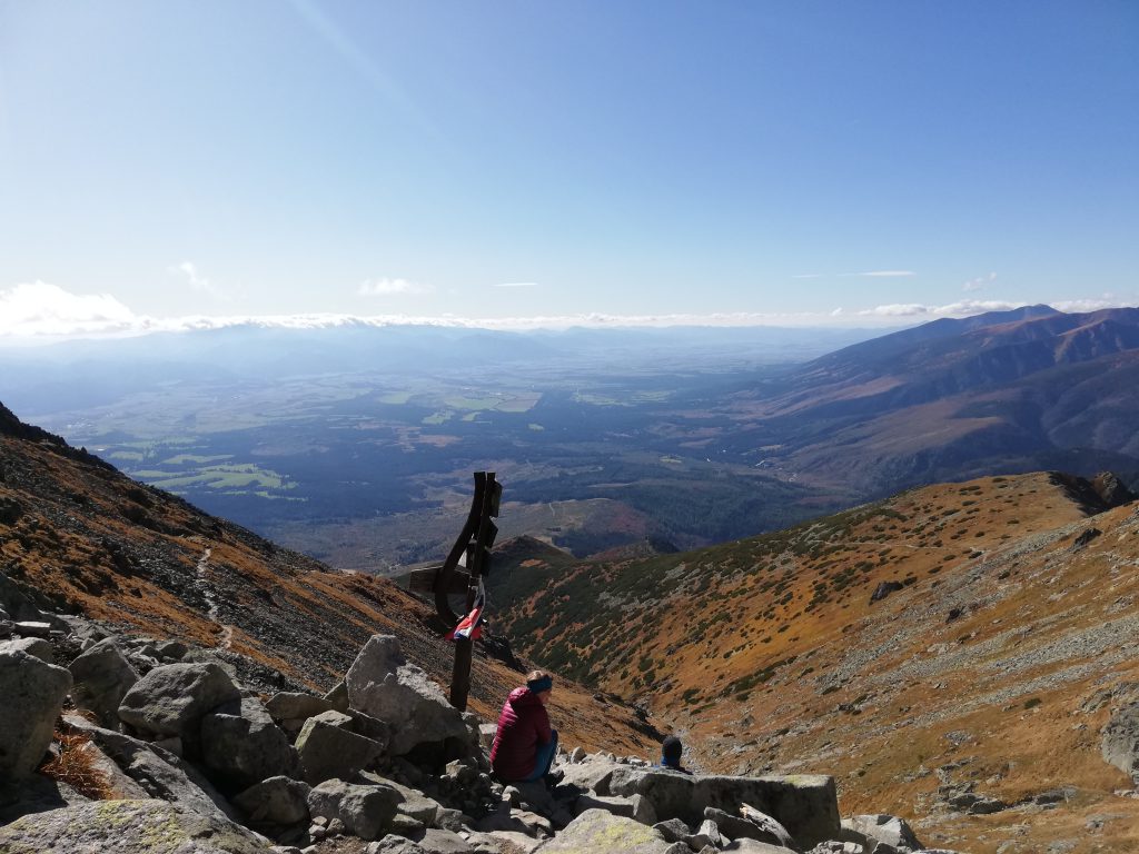
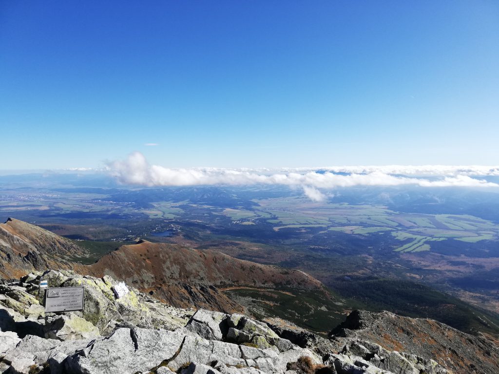
The views from the top were delightful, and I was lucky to make new friends in the Chata pod Rysmi (“Cottage below Rysy”)3 on 2250 meters, though it was otherwise rather lonely on this bright and clear autumn day.
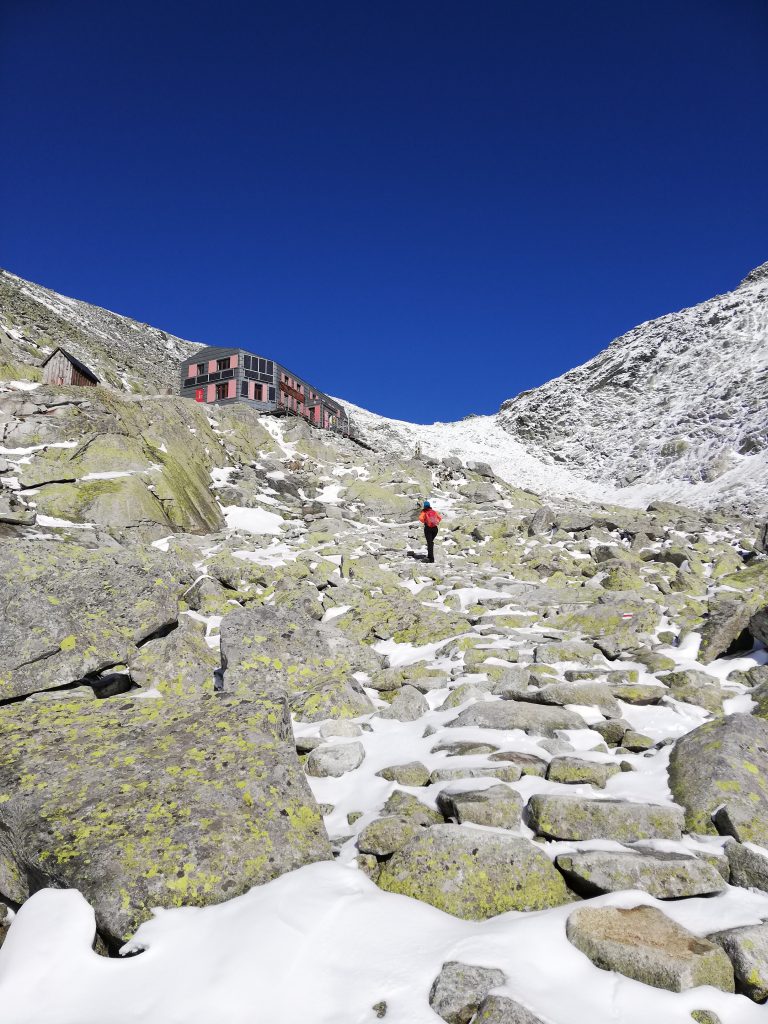
This refuge is the highest-located in Slovakia and quite small, but inviting and comfortable (but better avoid using that notorious outdoor toilet).
You will very likely encounter porters (the “Slovak Sherpas”) during your ascent carrying supplies up the mountain. Aside from helicopters, they are the only means for feeding the refuge, and their work is absolutely awe-inspiring.

Footnotes
1 some sources assert the name Kriváň stems from the Celtic word for rock; what can be since there are other mountains in Slovakia bearing a similar name (in the Malá Fatra you’ll find a mountain called Malý Kriváň, for instance)
2 likewise, Rysy is the highest mountain in Poland; climbing up from the Polish side is more difficult however and there is a severe avalanche threat during the winter months
3 just for the case you are interested in Slovak grammar – pod entails instrumental case, and here we need the plural form: Rysy – Rysmi
Featured image: The mountain lake Štrbské pleso