The Západné Tatry (Western Tatras) mountain range in Slovakia has slipped my attention as a destination for hiking and mountaineering tours until quite recently.
Casual visitors not only tend to confuse the western part of the High Tatras with this mountain range, but the Western Tatras also get vastly overshadowed by the popularity of its eastern counterpart.
It took me some time until I figured out convenient access points which were reachable by public transport, for the tourist infrastructure is far less extensive than in the High Tatras, and even less extensive than in the close-by lying Low Tatras.
Comparatively easy is the access by means of a direct bus connection to the Žiarska dolina entrance point (there is also a parking lot), starting at the train station in Liptovský Mikuláš. The bus drives about every two hours during the summer months and, as usual in Slovakia, the fare is fairly cheap (less than two Euros at the time of writing).
One reason for the lesser popularity of the Západné Tatry may be that there are no peaks which exceed the 2250 meter mark. Bystrá is the highest, boasting a height of 2248 meters (AMSL), followed by a mountain named Jakubiná with 2194 meters. As to the total area, the Western Tatras are slightly larger than the High Tatras, as a matter of fact.
Geologically, the Západné Tatry resembles the Belianske Tatry, consisting mainly of limestone rock that is, what entails a similar and very distinct vegetation. It appears greener, pristine and not as destitute of vegetation as the flora in the High Tatras which soar bulkily between those two other mountain ranges .
Baníkov, July 19
The Baníkov mountain is the highest peak (2178 meters) of the Western Tatras main ridge, and getting to the top was my goal on a oppressively hot summer day in mid July.
Scaling the mountain is not difficult, after all, and can be done from the Žiarska chata (1325 meters) in about two and a half hours by following a green marked trail. Water sources are abundant, so it is not necessary to carry liters and liters of water in your backpack.
The Žiarska chata itself can be reached doing an easy walk through the Žiarska dolina on a blue marked trail, negotiating an altitude difference of about four hundred meters in sum.
The area around is also of some historical interest. As the Second World War was in its final stage, fights were taking place in the vicinity of Žiar, and in the town itself. The building that today poses as the Žiarska chata was then occupied by a medical special unit of the Slovak resistance.
This in very brief manner described tour is sure to be repeated one day, for I rarely have seen such splendid a nature and the photos will only give a weak impression of it.
Photo gallery


")
")
")
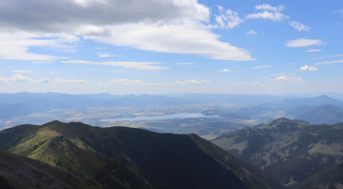
, view to Liptovský Mikuláš")

